
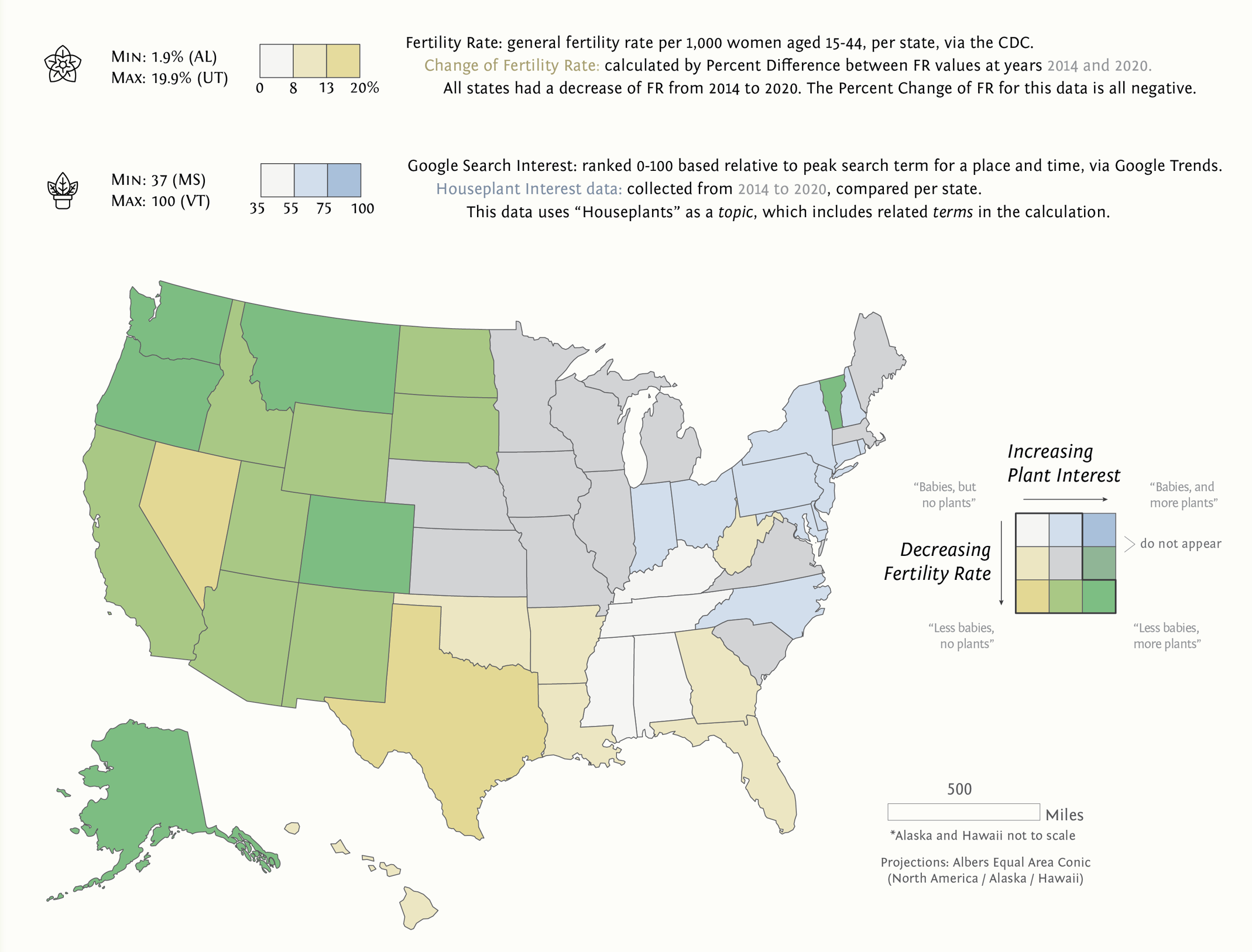
This project is my Lab 2 for UW-Madison Geog 572 Graphic Design in Cartography Class. The assignment was to greate an infographic with some spatial/map component. I’m proud of my illustrative work on this one, but I gave myself more work by including as much statistical information as I did. The choropleth map and bivariate analysis is where the bulk of the assignment was.
See the full size infographic here in a new page
Skills: ESRI ArcGIS Pro, Adobe Illustrator, cartographic design, gathering data, data presentation, infographic design