portfolio

Great Dividing Range Cycling Race

Learning raster processing, hillshades, and terrain coloration with a cycling race.

Published: Mar 01 2023

    Tagged:
  • Cartography
  • Infographic
  • UW-Mad Geog572
  • ArcGIS-Pro
  • Illustrator
  • Photoshop
A map of southeastern Australia with terrain brightly colored and a cycling route overlaid on top with cities and landmarks labeled.

This project is for my UW-Madison Geog 572 Graphic Design in Cartography Class.

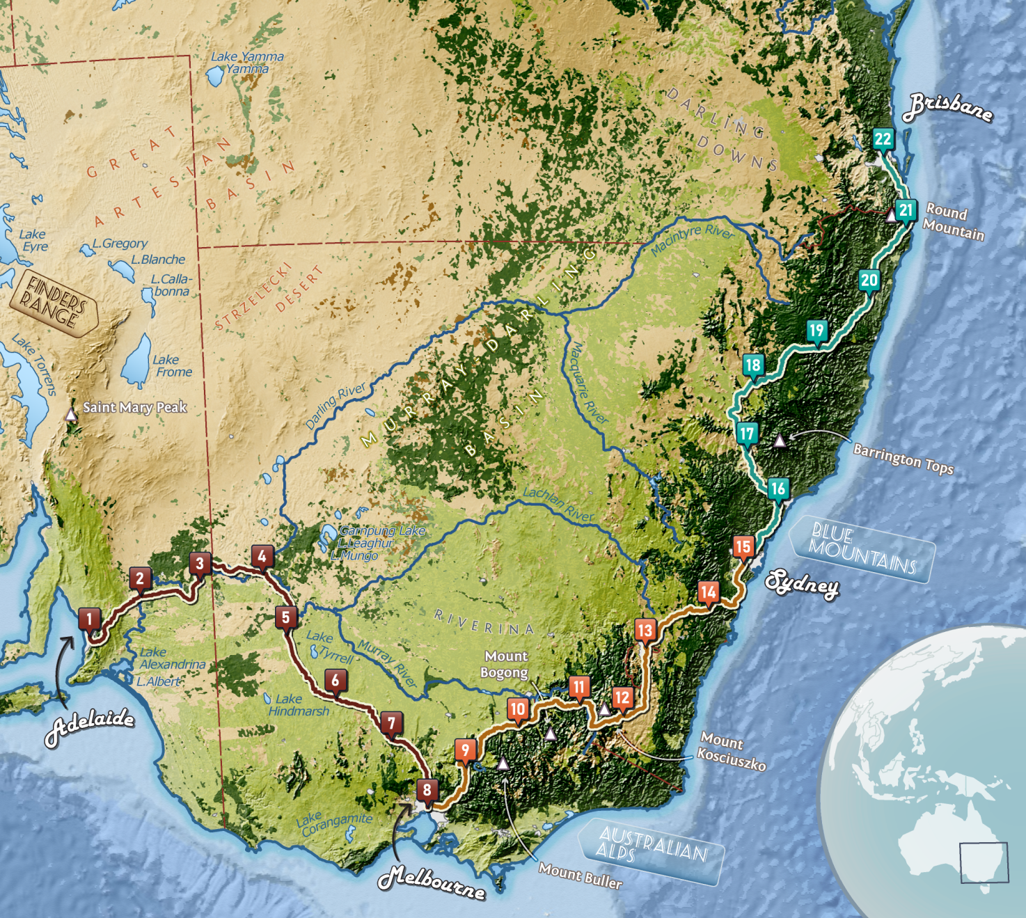
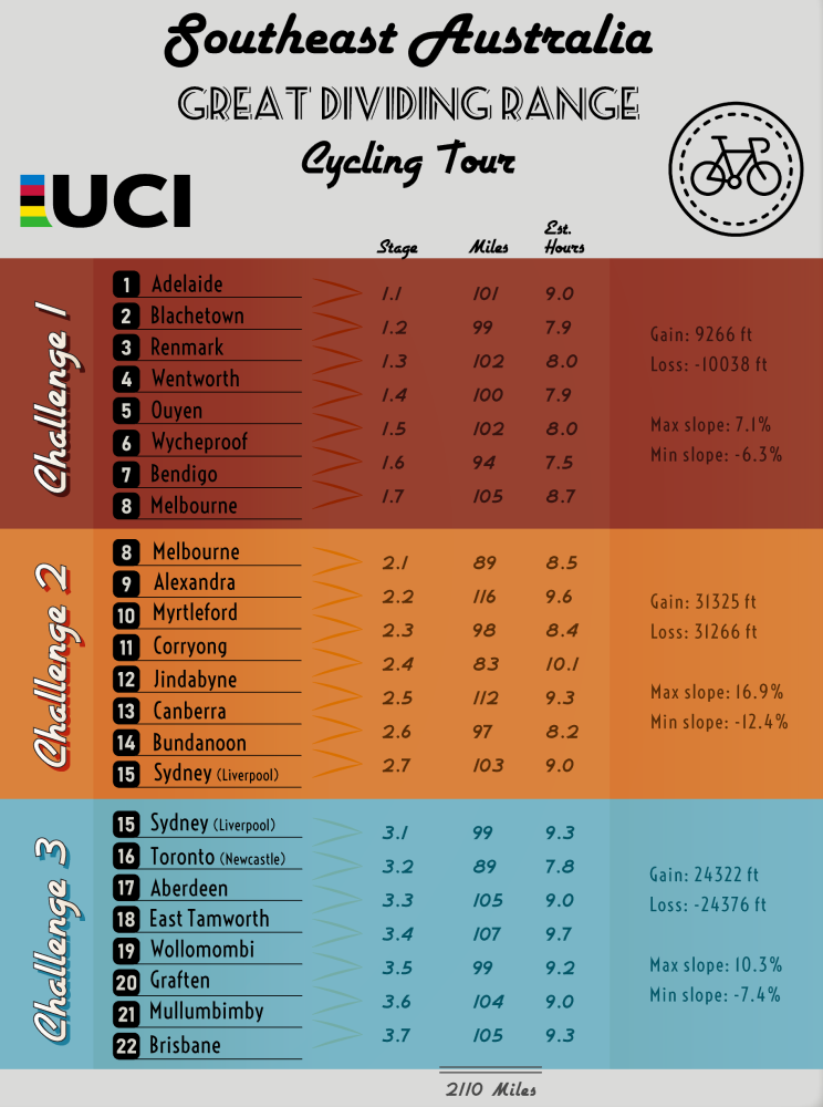
The raster image is one side of the project. The second side is a proposed companion graphic that gives names to the cities.

A graphic that shows labels for cities in the Cycling Race project

Skills: ESRI ArcGIS Pro, Adobe Illustrator, Adobe Photoshop, cartographic design, raster processing