This project is my Lab 3 for UW-Madison Geog 370 Cartography Class.
Skills: ESRI ArcGIS Pro, Adobe Illustrator, cartographic design, gathering data, data presentation, infographic design
· maps and data ·
· green engineering ·

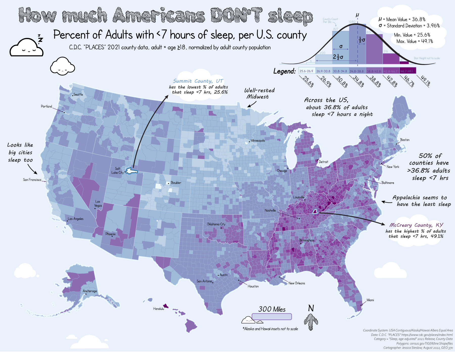
A choropleth map explorating how different counties in America sleep.
Published: Aug 15 2022
This project is my Lab 3 for UW-Madison Geog 370 Cartography Class.
Skills: ESRI ArcGIS Pro, Adobe Illustrator, cartographic design, gathering data, data presentation, infographic design