
This project is my Final Project for UW-Madison Geog 370 Cartography Class.
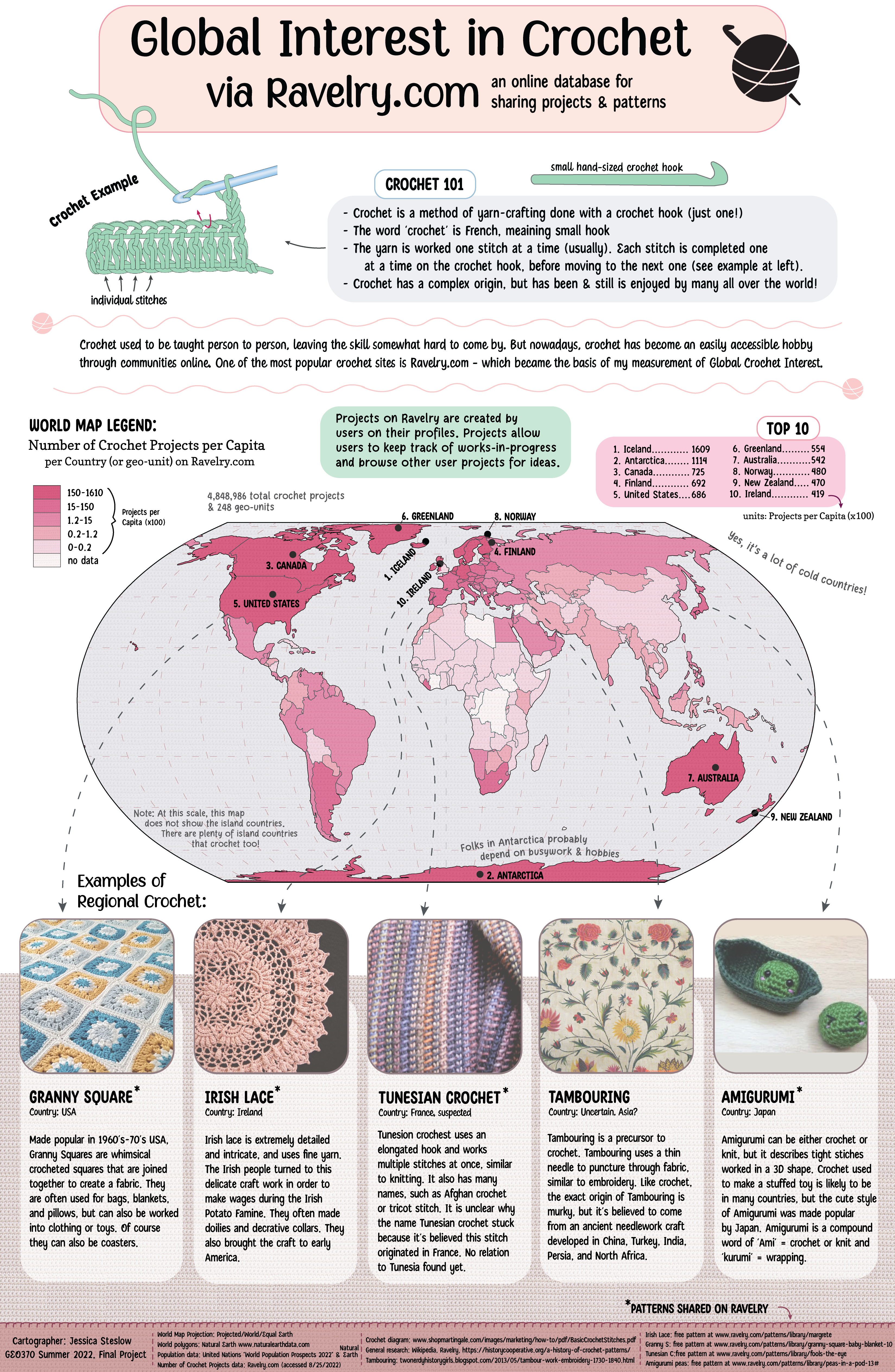
I created an infographic that illustrates information on global crochet interest with data taken from the crochet & knitting website Ravelry.com. I picked up crochet as a casual hobby, but I’ve always been fascinated by the variety and skill involved with different crochet stitches. I was inspired to explore this variety of crochet spatially for this project. As I researched the history of crochet, I learned that crochet interest is generally much higher now in modern times than in the past because of how accessible crochet education is with the internet. There are websites, videos, and social media where anyone can go to learn this new skill, whereas in the past it had to be taught person to person. Because of the link bewteen crochet education and the internet, I figured it would be appropriate to use the popular website Ravelry.com as a proxy for crochet interest.
Ravelry.com conveniently has data on crochet patterns per country of origin, which is what I ended up illustrating in a choropleth map. I also found a few patterns of importance in different countries to highlight some of the technical variety of different stitches. I knew my audience for this project (my teacher, my peers, friends/family) probably didn’t know about the topic of crochet to the depths of exploring different types of stitches, so I took the opportunity to fill out my infographic with basic information about the art of crochet. This project was highly enjoyable to research and design.
Skills: ESRI ArcGIS Pro, Adobe Illustrator, cartographic design, infographic design, image manipulation (color correction), data visualization